
ဖိုင်:Solomon Islands adm location map.svg

မူရင်းဖိုင် (SVG ဖိုင်, ၁၈၉၀ × ၁၀၉၇ pixels ကို အကြံပြုသည်, ဖိုင်အရွယ်အစား - ၁၄၈ KB)
အကျဉ်းချုပ်
| ဖော်ပြချက် |
Deutsch: Positionskarte der Salomonen
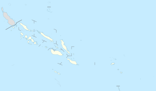
English: Location map of the Solomon Islands
|
||||||||||||
| ရက်စွဲ | |||||||||||||
| ရင်းမြစ် |
Own work using:
|
||||||||||||
| စာရေးသူ | NordNordWest | ||||||||||||

|
This map has been made or improved in the German Kartenwerkstatt (Map Lab). You can propose maps to improve as well.
|
လိုင်စင်သတ်မှတ်ခြင်း
Usage of this file with:

explanatory notes: Legally binding is only the full legalcode. For a free usage I recommend to respect the following licence conditions:
1. Provide my name as given above: NordNordWest,
2. a copy of, or the URI for, the applicable license: https://creativecommons.org/licenses/by-sa/3.0/de/legalcode,
3. the title of the work,
4. in the case of an adaptation, a credit identifying the use of the work in the adaptation.
This license and the rights granted hereunder will terminate automatically upon any breach by you of the terms of this license. Any of the above conditions can be waived if you get permission from the copyright holder. If you have questions or wish differing conditions, please contact me through nnwest or my discussion page ![]() t-online.de
t-online.de
- သင်သည် လွတ်လပ်စွာ:
- မျှဝေရန် – ဖန်တီးမှုကို ကူးယူရန်၊ ဖြန့်ဖြူးရန်နှင့် ထုတ်လွှင့်ရန်
- ပြန်ရောနှောရန် – ဖန်တီးမှုကို ပြင်ဆင်ညှိနှိုင်းရန်
- အောက်ပါ အခြေအနေများတွင်:
- မှတ်ယူနိုင်ခြင်း – ပြောင်းလဲမှုများ ပြုလုပ်ခဲ့ပါက ဖန်တီးသူ သို့မဟုတ် လိုင်စင်ရှိသူမှ သတ်မှတ်သော အမျိုးအစားကို လိုက်နာရမည် (ဆိုလိုသည်မှာ သင့်အား သို့မဟုတ် သင့်ဖန်တီးမှုတွင် အသုံးပြုခြင်းအား ထောက်ခံချက်ပေးသည်ဟု မဆိုလိုပါ)။
- ထပ်တူမျှဝေ – ဤဖန်တီးမှုအား ပြင်ဆင်ခြင်း၊ ပြောင်းလဲခြင်း သို့မဟုတ် ထပ်ဆင့် ဖန်တီးခြင်း ပြုလုပ်ပါက ရရှိလာသော ဖန်တီးမှုကို ဤဖန်တီးမှုနှင့် သို့မဟုတ် ဆင်တူသော လိုင်စင်ဖြင့်သာ ဖြန့်ချိသင့်သည်။

ဖိုင်မှတ်တမ်း
ဖိုင်ကို ယင်းနေ့စွဲ အတိုင်း မြင်နိုင်ရန် နေ့စွဲ/အချိန် တစ်ခုခုပေါ်တွင် ကလစ်နှိပ်ပါ။
| နေ့စွဲ/အချိန် | နမူနာပုံငယ် | မှတ်တမ်း ဒိုင်မန်းရှင်းများ | အသုံးပြုသူ | မှတ်ချက် | |
|---|---|---|---|---|---|
| ကာလပေါ် | ၁၆:၅၄၊ ၂၀ နိုဝင်ဘာ ၂၀၂၀ | | ၁၈၉၀ × ၁၀၉၇ (၁၄၈ KB) | NordNordWest | corr |
| ၁၈:၃၆၊ ၁၅ မတ် ၂၀၁၇ |  | ၁၈၉၀ × ၁၀၉၇ (၁၄၇ KB) | NordNordWest | == {{int:filedesc}} == {{Information |Description= {{de|1=Positionskarte der Salomonen}} {{en|1=Location map of the Solomon Islands}} {{Location map series N |stretching=101 |top=-4.3 |bottom=-13.5 |left=154.4 |right=170.4 }} |Source={{Own using}} * Un... |
ဖိုင်သုံးစွဲမှု
ဤဖိုင်ကို အသုံးပြုထားသော စာမျက်နှာများမရှိပါ။
ဂလိုဘယ် ဖိုင်သုံးစွဲမှု
အောက်ပါ အခြားဝီကီများတွင် ဤဖိုင်ကို အသုံးပြုထားသည်-
- ast.wikipedia.org တွင် အသုံးပြုမှု
- Ḥoniara
- Módulu:Mapa de llocalización/datos/Islles Salomón
- Módulu:Mapa de llocalización/datos/Islles Salomón/usu
- Makira
- Kirakira
- Islles Florida
- Islles Nueva Xeorxa
- Vangunu
- Islla de Rennell
- Kolombangara
- Golfu de Kula
- Llaguna de Marovo
- Ranongga
- Nggatokae
- Simbo
- Islles Arnarvon
- Islla Bellona
- Islla de Ghizo
- Islles Duff
- Islla Malaita
- Islla de Savo
- Gavutu
- Islla Kennedy
- Islles Reef
- Islla Choiseul
- Vella Lavella
- Islla Nueva Xeorxa
- Tinakula
- Islla Furona
- Islla de Santa Isabel
- Malaita Sur
- Islla Nendö
- Taumako
- Rennell Este
- Islles Santa Cruz
- Tulagi
- Islla Fera
- Fatutaka
- Anuta
- Tikopia
- Pavuvu
- Utupua
- bn.wikipedia.org တွင် အသုံးပြုမှု
- de.wikipedia.org တွင် အသုံးပြုမှု
ဤဖိုင်ကို အခြားနေရာများတွင် အသုံးပြုထားမှုများအား ကြည့်ရှုရန်။